Chapter 2
App Dialogs
Use from the main screen to access app dialogs. Dialogs can also be shown by tapping different UI elements, or triggered using actions.
Use from the main screen to access app dialogs. Dialogs can also be shown by tapping different UI elements, or triggered using actions.
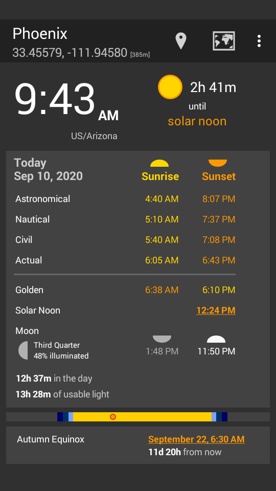
Suntimes displays the location name and coordinates in the action bar.


Tap to change the location.
Tap to update the current location.
Tap
to show the location on a map. Visibility of the map button can be changed from Suntimes -> Settings User Interface -> Show Map Button.
Suntimes displays the current time and time zone in the upper left.

Tap the time zone, or use
: -> Set Time Zone to change the time zone.
Suntimes will display an info icon when daylight saving (or a similar rule) is in effect.
Suntimes will display a warning icon when the time zone disagrees with local mean time. This is a common misconfiguration.
Suntimes will announce the time (and other changes to the UI) when using verbose TalkBack. Suntimes -> Settings User Interface -> Verbose TalkBack.
Suntimes tracks the time until the next event in the upper right.
Tap the event field, or swipe left or swipe right, to step through events.
Suntimes displays today’s sunrise, sunset, and twilight times.

Use
: -> View date to scroll to a specific day, or swipe left or swipe right to see past and future days. Tap
or
to reset to today.
Tap the column headers to show the time until sunrise or sunset.
Tap noon or the lightmap to open the sun dialog.
Suntimes can also display custom events. Suntimes -> Settings User Interface -> Manage Events
Visibility of the twilight fields can be changed from the User Interface settings. Suntimes -> Settings User Interface -> Display. The lightmap can be toggled from User Interface -> Show Light Map.
Suntimes can also put emphasis on one of the fields. This can be changed from User Interface -> Emphasize Field.
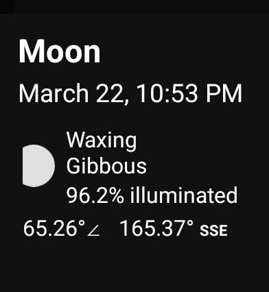
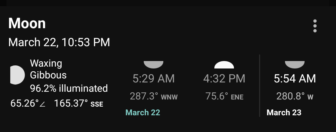
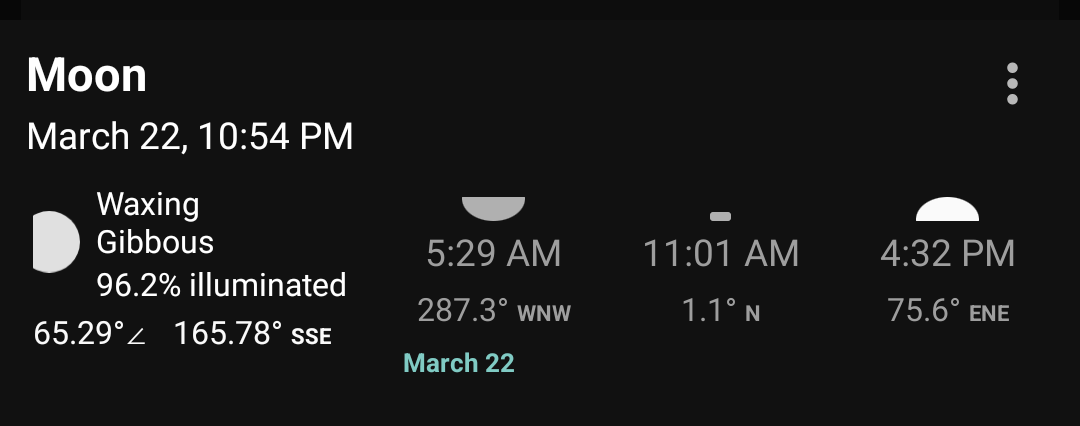
Suntimes displays moonrise, moonset, phase and illumination. Tapping this info opens the moon dialog.

Visibility of the moon info can be toggled from the User Interface settings. Suntimes -> Settings User Interface -> Show Moon.
Suntimes displays the next solstice, equinox, or cross-quarter day. Tapping this field opens the solstice dialog.

Visibility of solstice tracking can be toggled from the User Interface settings. Suntimes -> Settings User Interface -> Show Solstice / Equinox.
Suntimes displays the data source in the lower right. Tapping this field opens General settings.

The use elevation option can be toggled from the lower left. Altitude-based refinements will be applied when enabled.
Visibility of the data source can be changed from the User Interface settings. Suntimes -> Settings User Interface -> Show Data Source.
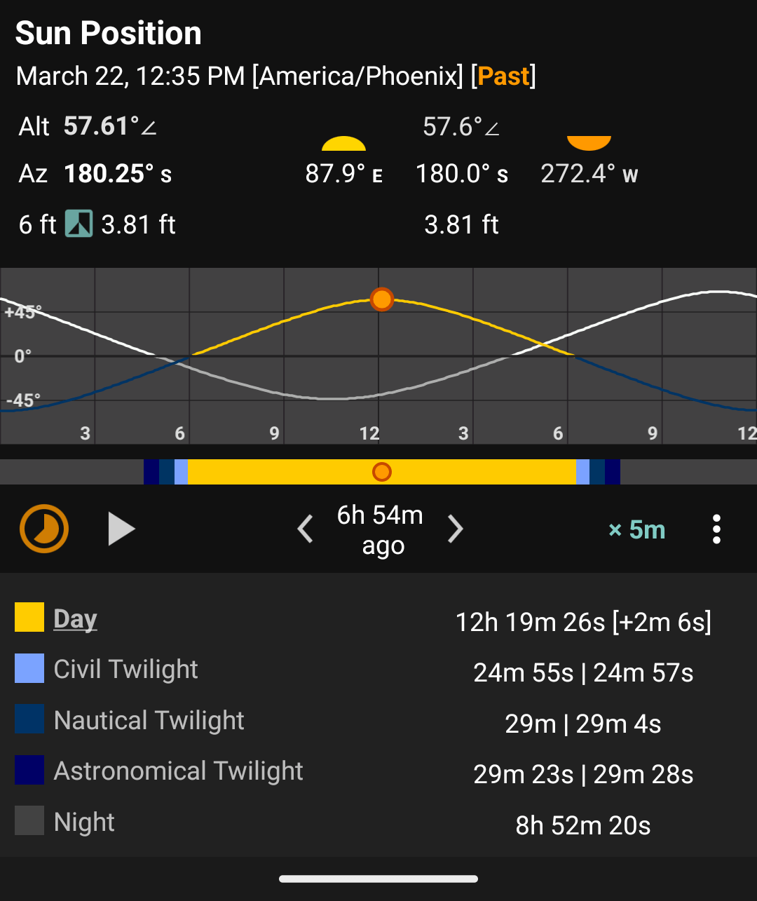
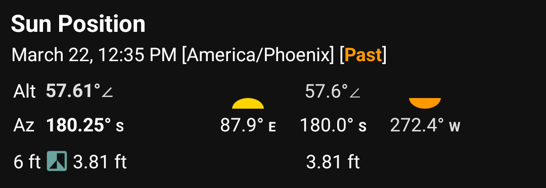
Suntimes displays the sun’s current azimuth and altitude, azimuth at sunrise and sunset, and altitude at solar noon.
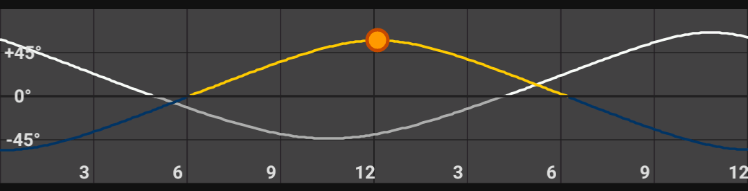
Suntimes can display a graph of daylight and twilight periods.

Use Suntimes -> Settings User Interface -> Show Light Map to show the light map view on the main screen.
Use
: -> Altitude Graph to toggle the altitude graph, and
: -> Options to change the graph’s options.
Changes to the graph options are also applied to home screen widgets.
Suntimes can find the time when the sun will be at a given angle in the sky.
Use
: -> Seek Altitude to specify the angle.
Tap to find the rising time, or to find the setting time.

Tapping the sunrise, noon, or sunset areas (next to the altitude field) will seek to the time of those events.

Suntimes can animate the light map and altitude graphs at different rates:
5m the frames are 5 minutes apart.1d the frames are 24 hours apart.Tap and to step through frames one at a time.
Tap to play the animation, to pause it, and to reset to the current moment.
Use
: -> View date to open other dialogs at the selected date/time.
Suntimes can find the length of the shadow cast by an object with a given height.
Use
: -> Object Shadow to change the height.
Tap to reduce the object’s height, and to increase it.

The object height can also be changed from Suntimes -> Settings User Interface -> Object Shadow.
The length of the shadow will be ∞ when the sun is below the horizon.
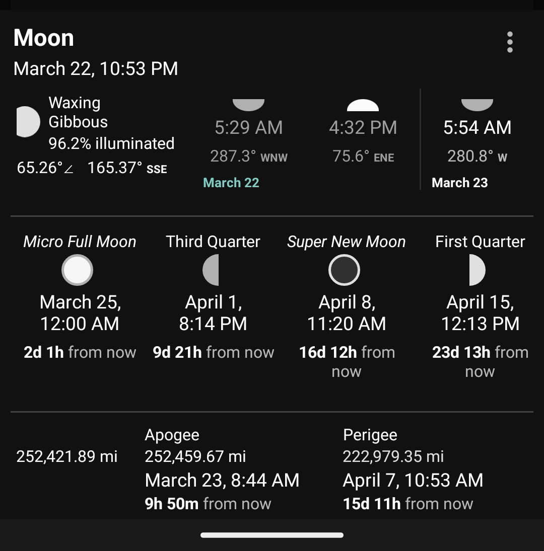
Suntimes displays the moon’s current phase, illumination, azimuth, and altitude.
Use Suntimes -> Settings User Interface -> Show Moon to show this info in the main table.
Use
: -> Playback to show the controls.
Tap and to step through positions at 5 minute intervals. Tap to reset to the current time (on the selected day).
Suntimes displays the time of moonrise and moonset.
Swipe left or right to scroll to past or upcoming days, or tap to reset to today.
The month views will scroll automatically to show dates around the selected day.
Suntimes can also display the time of lunar noon and lunar midnight.
Use
: -> Show Lunar Noon to toggle this option.
Suntimes displays the time/date of the moon’s major phases (synodic month), and labels the “Super Moons”.
Swipe left or right to scroll to future or past months, or tap to reset the view.
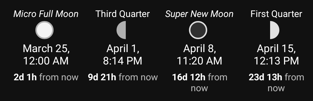
Use
: -> Columns (phases) to change the number of columns displayed.
Suntimes displays the time/date of the moon’s apogee and perigee (anomalistic month), and the moon’s current distance.
Swipe left or right to scroll to future or past months, or tap to reset the view.

Tap on a field to show the context menu button.
Use
: -> Set Alarm to set an alarm for the selected event.
Use
: -> View Date to open other dialogs at the selected date/time.
Use
: -> Share to copy text to clipboard.
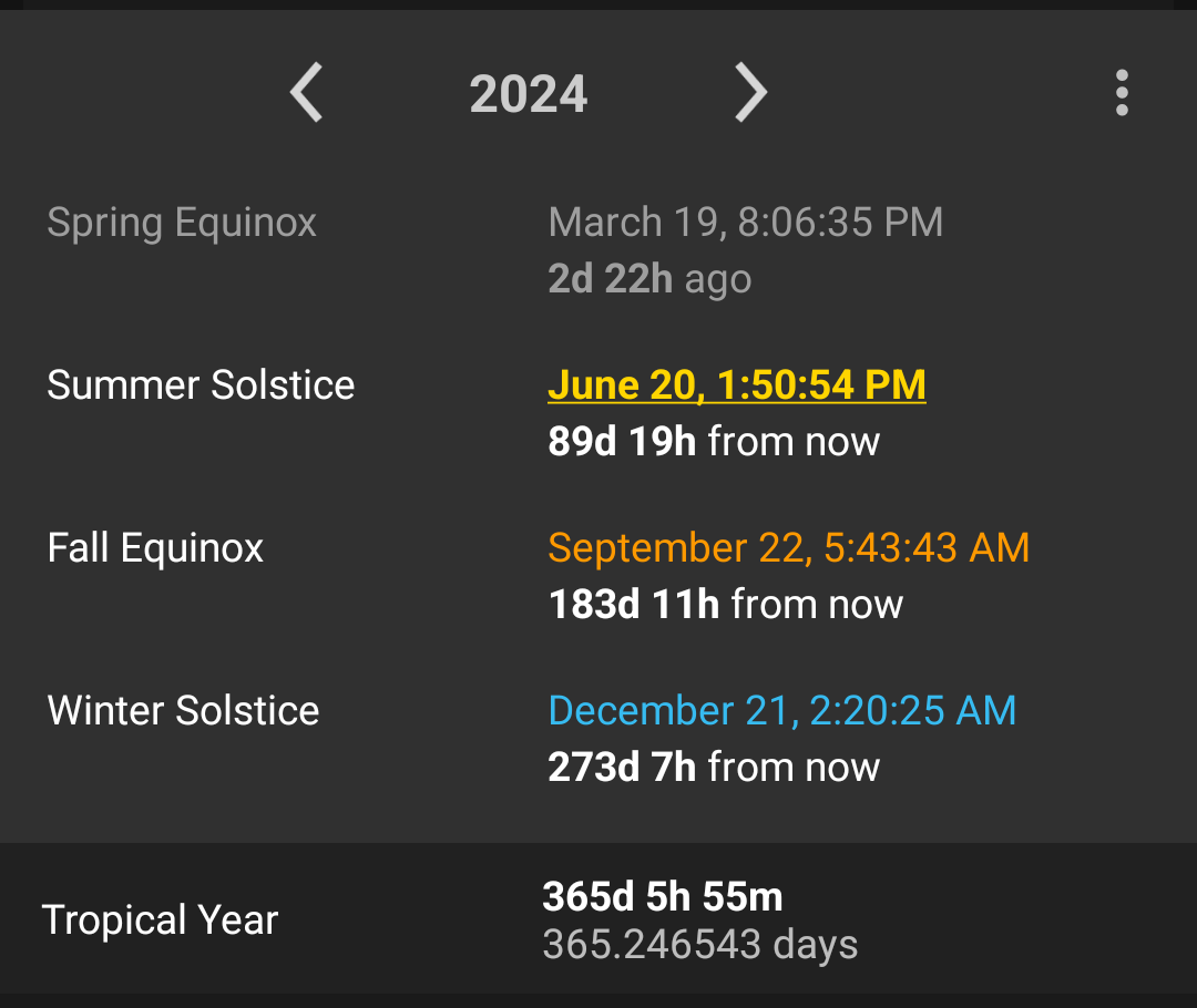
Suntimes displays the solstices and equinoxes, and can track the number of days until or since those events.
![]()
![]()
Use
: -> Track to change tracking to the recent, nearest, or upcoming event.
This option can also be changed from the User Interface settings.
Suntimes -> Settings User Interface -> Solstice Tracking.
Tracking can be enabled in the main view using
Suntimes -> Settings User Interface -> Show Solstice / Equinox.
Suntimes can display the midpoints between each solstice and equinox (the cross-quarter days).
![]()
![]()
Use
: -> Cross-Quarter Days to toggle this setting.
This option can also be changed from the User Interface settings.
Suntimes -> Settings User Interface -> Cross-Quarter Days.
Changes to the Cross-Quarter Days setting are also applied to home screen widgets.
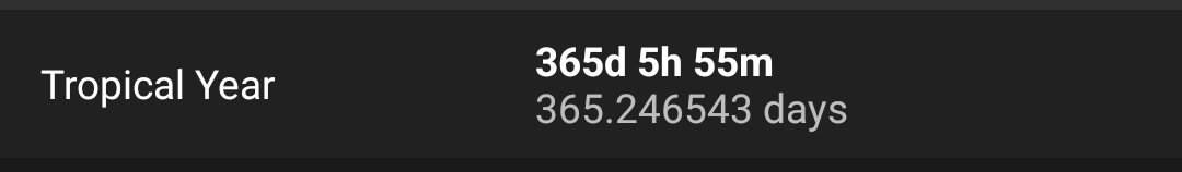
Suntimes displays the length of the tropical year.
Tap on a row to select it and reveal the context menu button.
Use
: -> Set Alarm to set an alarm for the selected event.
Use
: -> View Date to open other dialogs at the selected date/time.
Use
: -> Share to copy text to clipboard.
Use
: -> Options to change the map’s options.
The map options are also applied to home screen widgets.
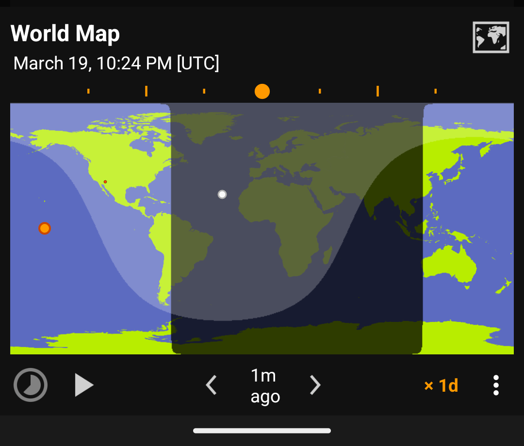
Suntimes can animate the world map at different rates.
15m the frames are 15 minutes apart.1d the frames are 24 hours apart.Tap and to step through frames one at a time.
Tap to play the animation, to pause it, and to reset to the current moment.
Long pressing the map will also play the animation, and tapping it again will pause.
Suntimes can share individual frames, or record all frames in an animation.
Use
: -> Share to share the current map view.
To share an animation, long press
to start recording.
When finished, tap
(where the play button was previously) to share the frames (as .zip).
Use
: -> View date to open other dialogs at the selected date/time.
Suntimes can be configured to display a custom world map background.
Use
: -> Center -> Set Background to change the map’s background image.


To use backgrounds: store full-sized images somewhere on your device, then open with Set background. Suntimes uses URI permissions to access images stored on the SD card.
Suntimes Map Pack provides a large collection of background images. This addon makes backgrounds available automatically, however they can also be downloaded individually.
The following backgrounds were created by reprojecting Blue Marble and Natural Earth data using QGIS.
| Projection | Map Backgrounds (click for full-size image) |
|---|---|
| Equidistant Rectangular | 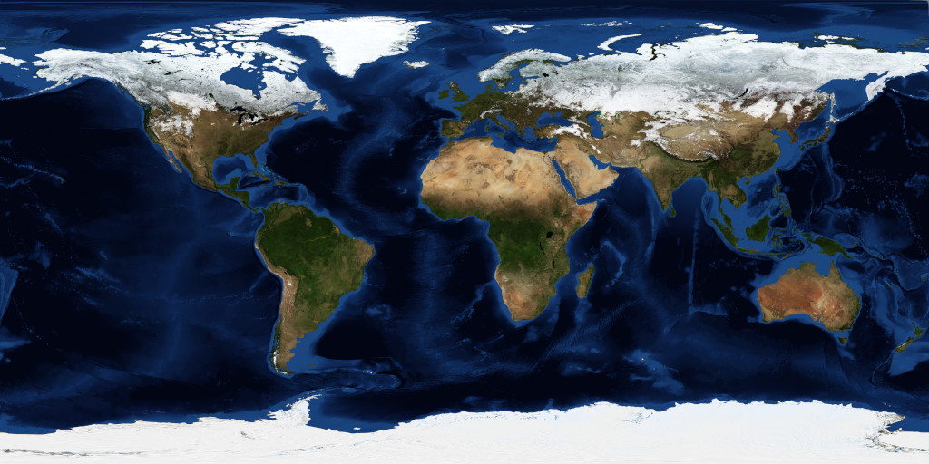 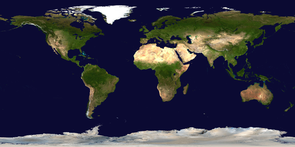 |
| Equidistant Azimuthal | 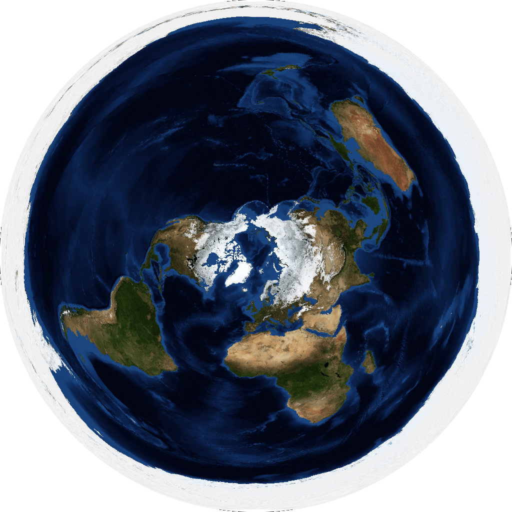 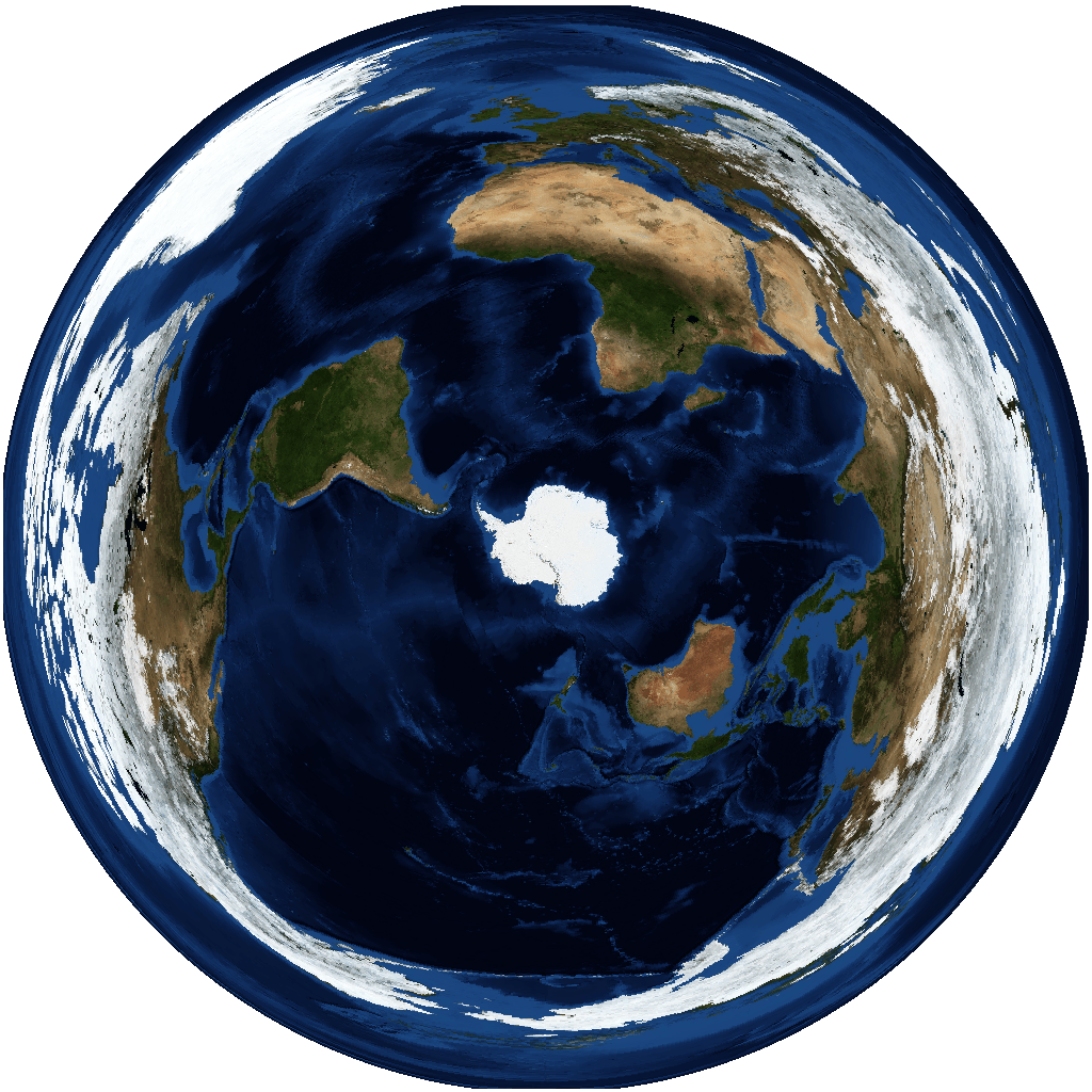 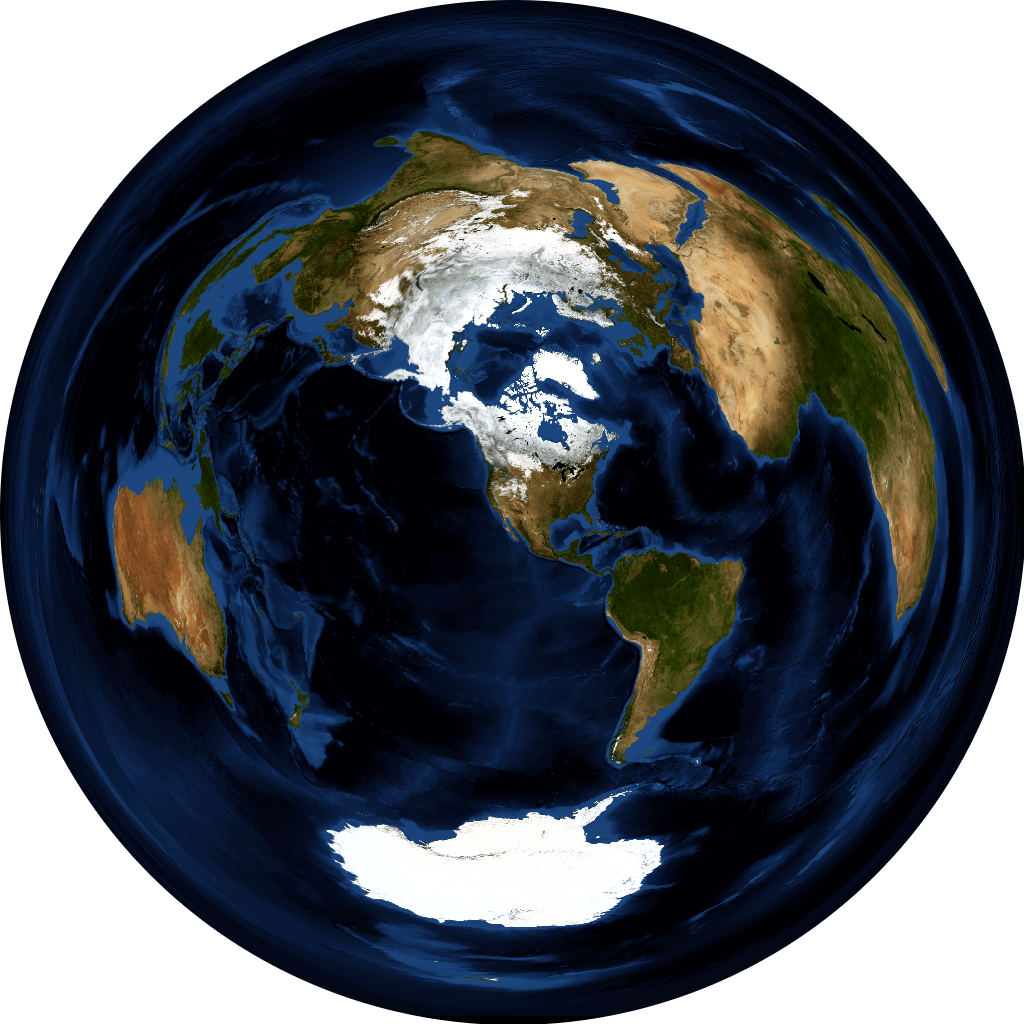  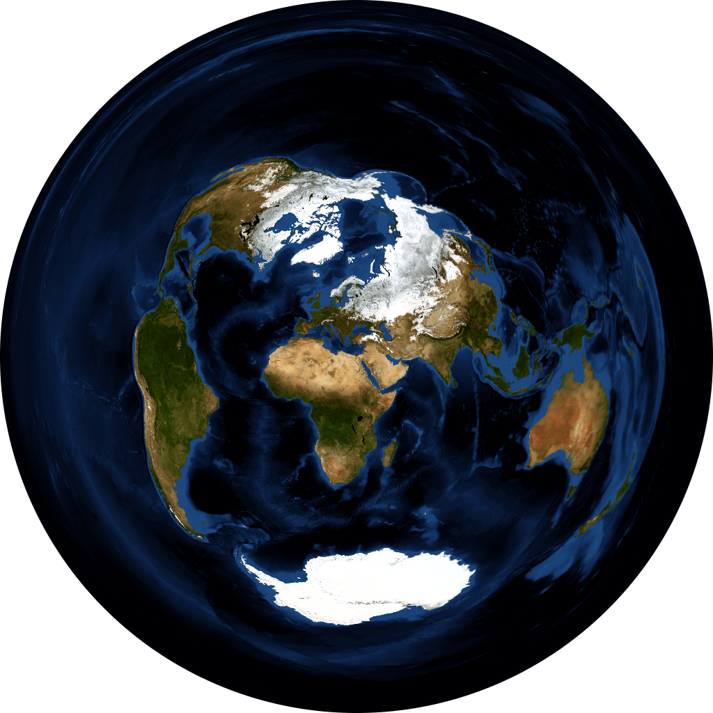 |
Made with Natural Earth. https://www.naturalearthdata.com/about/terms-of-use/
NASA Earth Observatory. Blue Marble: Next Generation. https://visibleearth.nasa.gov/view_cat.php?categoryID=1484
png or jpeg with recommended dimensions 1024 x 512 or 1024 x 1024 or greater (will be scaled to fit the screen).| World Map | Aspect | Projection | Center | proj4 |
|---|---|---|---|---|
| Basic | 2:1 |
Equidistant Rectangular | [0,0] |
+proj=eqc +lat_ts=0 +lat_0=0 +lon_0=0 +x_0=0 +y_0=0 +a=6371007 +b=6371007 +units=m +no_defs |
| Polar [north] | 1:1 |
Equidistant Azimuthal | [90,0] |
+proj=aeqd +lat_0=90 +lon_0=0 +x_0=0 +y_0=0 +datum=WGS84 +units=m +no_defs |
| Polar [south] | 1:1 |
Equidistant Azimuthal | [-90,0] |
+proj=aeqd +lat_0=-90 +lon_0=0 +x_0=0 +y_0=0 +datum=WGS84 +units=m +no_defs |
| Azimuthal Equidistant | 1:1 |
Equidistant Azimuthal | [LAT,LON] |
+proj=aeqd +lat_0=LAT +lon_0=LON +x_0=0 +y_0=0 +a=6371000 +b=6371000 +units=m +no_defs where LAT and LON define the center of the projection. |
| Mercator | 1:1 |
Web Mercator | [0,0] |
+proj=merc +lat_ts=0 +lon_0=0 +x_0=0 +y_0=0 +R=6378137 +units=m +no_defs |
| Mercator equal-area | 1:1 |
Sinusoidal | [0,0] |
+proj=sinu +lon_0=0 +x_0=0 +y_0=0 +datum=WGS84 +units=m +no_defs |
| Van der Grinten | 1:1 |
Van der Grinten | [0,0] |
+proj=vandg +lon_0=0 +x_0=0 +y_0=0 +R_A +a=6371000 +b=6371000 +units=m +no_defs |
white foreground (landmasses), and transparent background (ocean). The final coloring is determined by the app’s theme.